Popular Posts
-
Albinism (from Latin albus, meaning "white") is a lack of pigmentation in the eyes, skin and hair. Albinism is an inherited condit...
Wednesday, February 08, 2012
Amazing Aurora Australis
Saturday, January 28, 2012
The Morning Glory, Rare Meteorological Phenomenon
Despite being studied extensively, the Morning Glory cloud is not clearly understood.
Regardless of the complexity behind the nature of this atmospheric phenomenon, some conclusions have been made about its causes. Through research, one of the main causes of most Morning Glory occurrences is the mesoscale circulations associated with sea breezes that develop over the peninsula and the gulf. On the large scale, Morning Glories are usually associated with frontal systems crossing central Australia and high pressure in northern Australia. Locals have noted that the Morning Glory is likely to occur when the humidity in the area is high, which provides moisture for the cloud to form, and when strong sea breezes have blown the preceding day.
Funnel cloud is also very interesting and you can also check out this funny cloud post.
Wednesday, May 23, 2007
Lightning Hits A Tree
This is the most amazing lightning strike you will ever see. Lightning hit a tree approximately 20 feet from the camera. The tree died a few months after the strike.
Wednesday, April 04, 2007
Beautiful Pictures From Around The World
Friday, March 23, 2007
Beautiful Hi Res Aurora Borealis
Tuesday, March 06, 2007
Moon Above North Pole
Wednesday, January 10, 2007
Friday, December 08, 2006
Amazing Sunset
Saturday, November 04, 2006
Multiple Lightning Strokes


Lightning voltages are usually greater than 20 kV, but can be millions of volts. Researchers and observers have determined that when viewed from a distance, a lightning bolt usually has a question mark shape (?). Most lightning strike occurrences contain multiple strokes. Twenty percent (20%) of these occurrences are only one stroke. Eighty percent (80%) are two or more strokes. The mean stroke occurrence is five to six and the maximum has been measured at twenty-five.
The time between strokes can vary from 100 microseconds to 10 milliseconds during any stroke occurrence.
The current of a lightning strike leader will usually range from 30 to 35 kA. A lightning strike leader is a stream of electrons which appears as a dim spark emerging from a cloud to the ground during the early stages of lightning development. Following the lightning strike leader there may be many multiple-lightning strike occurrences where the average measured lightning strike amplitudes will range from 14 to 40 kA. The duration of the total lightning strike phenomena can have a period between 500 ms and 1 second.
One-third of the second lightning strikes which occurs during multiple lightning strike occurrences are larger in magnitude than the initial strike. The maximum strike intensities (positive and negative) measured were +300 kA and -200 kA. These, however, will occur less than one percent (1%) of the time. The effects of a lightning strike can be measured and the effects felt, 1.2 to 12.5 miles from the strike site. This may be due to lightning currents flowing through the ground. In addition during multiple lightning strikes, the location of the terminating lightning strikes have been observed to vary and may be spaced apart from .2 to 4.5 miles. These data are based on actual measurements. These are long duration current strikes which may last from 10 to 500 ms (30 cycles of 60 Hz lines powers). The amplitude of this long duration strike may range from 10 to 100 amperes and can flow through the power system. This may help to explain why service entrance suppressors sometimes fail during a lightning storm. The long conduction period and the resulting thermal effects can be the consequence of a lightning storm. Since suppressors are transient Voltage devices, the long duration currents may exceed the duty cycle of the device if the device rating is not high enough.
Tuesday, October 17, 2006
Aurora (Northern Lights)
Aurora borealis in time lapse. Images taken from BC, Canada.
Tuesday, August 22, 2006
Funnel Cloud

A funnel cloud is a funnel-shaped cloud of condensed water droplets, associated with a rotating column of air and extending from the base of a cloud (usually a cumulonimbus or towering cumulus cloud) but not reaching the ground or a water surface. A funnel cloud is usually visible as a cone-shaped or needlelike protuberance from the main cloud base. Funnel clouds frequently form in association with supercell thunderstorms.
If a funnel cloud touches the ground it becomes a tornado. All tornadoes begin as funnel clouds, but many funnel clouds do not make ground contact and so do not become tornadoes. If there is a dust cloud near the ground beneath the funnel or if the funnel contains dust or debris, rather than just condensed water, a tornado exists. Conversely, some tornadoes may appear only as a debris swirl, with no obvious funnel cloud extending below the rotating cloud base.

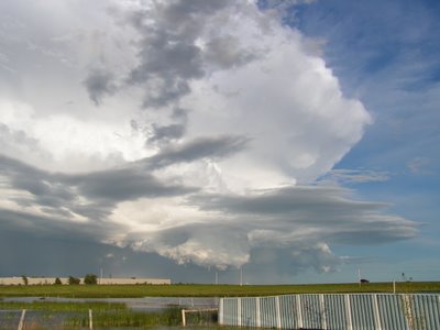
Todd Snyder sent me this photo. It was taken from just west of Calgary, Alberta.
Saturday, July 15, 2006
Clouds and lightning, pictures by Goran Katic


And few more from Goran Katic. These beautiful photos are uploaded in 1024 x 768 resoulution so you can also use them as wallpaper.Friday, July 07, 2006
Fire rainbow, natural phenomena

June 19, 2006
Known in the weather world as a circumhorizontal arc, this rare sight was caught on film on June 3 as it hung over northern Idaho near the Washington State border (map of Idaho).
The arc isn't a rainbow in the traditional sense—it is caused by light passing through wispy, high-altitude cirrus clouds. The sight occurs only when the sun is very high in the sky (more than 58° above the horizon). What's more, the hexagonal ice crystals that make up cirrus clouds must be shaped like thick plates with their faces parallel to the ground.
When light enters through a vertical side face of such an ice crystal and leaves from the bottom face, it refracts, or bends, in the same way that light passes through a prism. If a cirrus's crystals are aligned just right, the whole cloud lights up in a spectrum of colors.
This particular arc spanned several hundred square miles of sky and lasted for about an hour, according to the London Daily Mail.
Saturday, July 01, 2006
Sunset, pictures from Croatia
Hvar
Brac
Vis
Zadar
Finally, one more thing should be said, that is "Zadar has s nicer sunset than California " - so said Alfred Hitchcock in 1964.
Tuesday, June 20, 2006
Heaven through lens


I promised some heavenly photos, didn't I? So here they are. That is the closest that man could get to Heaven through camera.
Monday, June 19, 2006
The sky above us


Many cultures ascribed strong religious qualities to Earth's sky, believing it to be the home of the heavens and various deities. Among the Chinese, in certain situations, sky means god. For example, people may say "They became friends after several fights: this is the idea of the sky" or "Why does the sky always fool me?" Some religion and art historians believe that in Christianity, in particular, the connection between heaven and sky arose because of a medieval painting technique, where different places were drawn separately on the same picture. Heaven, a different and more important world, was usually painted above the earthly world and was separated from it by clouds.
Tomorrow I'll post some heavenly photos. ;)